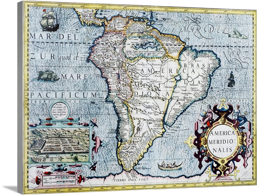
<p>South America, 17th century Dutch map. This shows the new continent that was being discovered by European explorers. The shape is distorted because it had not yet been accurately mapped. Two large rivers in Brazil are shown flowing from a large lake in eastern Brazil. The western coastline is by now fairly accurately mapped, but it was still not realised that Tierra del Fuego (bottom centre) in the Straits of Magellan, was a group of islands and not part of a large southern continent. The inset at lower left shows the Incan city of Cuzco in Peru. This map, published around 1630 by Jodocus Hondius, continued the earlier work of Gerard Mercator.</p>


Elevate any room with our handcrafted stretched canvas gallery wraps. Printed with archival inks and wrapped around a 1.25” inch solid wood stretcher bar, our giclée big canvas art prints are a timeless option for any decor style or space.
<p>Our giclée canvas art prints are produced with high quality, UV-resistant, environmentally-friendly, latex inks and artist grade, polycotton canvas. We pride ourselves on color accuracy and image clarity to ensure your new canvas wall art lasts for years to come.</p>

<p>Assembled in the USA, each of our 1.25” inch gallery wrapped canvas art prints is stretched and stapled by our highly skilled craftspeople. Each canvas print is carefully handcrafted to ensure taut canvas wraps and clean corners for outstanding quality and durability.</p>

<p>Our handcrafted stretched canvas prints include sawtooth hangers for an easy and secure installation.</p>
 Georgette Douwma
Educational
History
World History
Early Modern
Maps
Antique Maps
Maps by Continent
Georgette Douwma
Educational
History
World History
Early Modern
Maps
Antique Maps
Maps by Continent