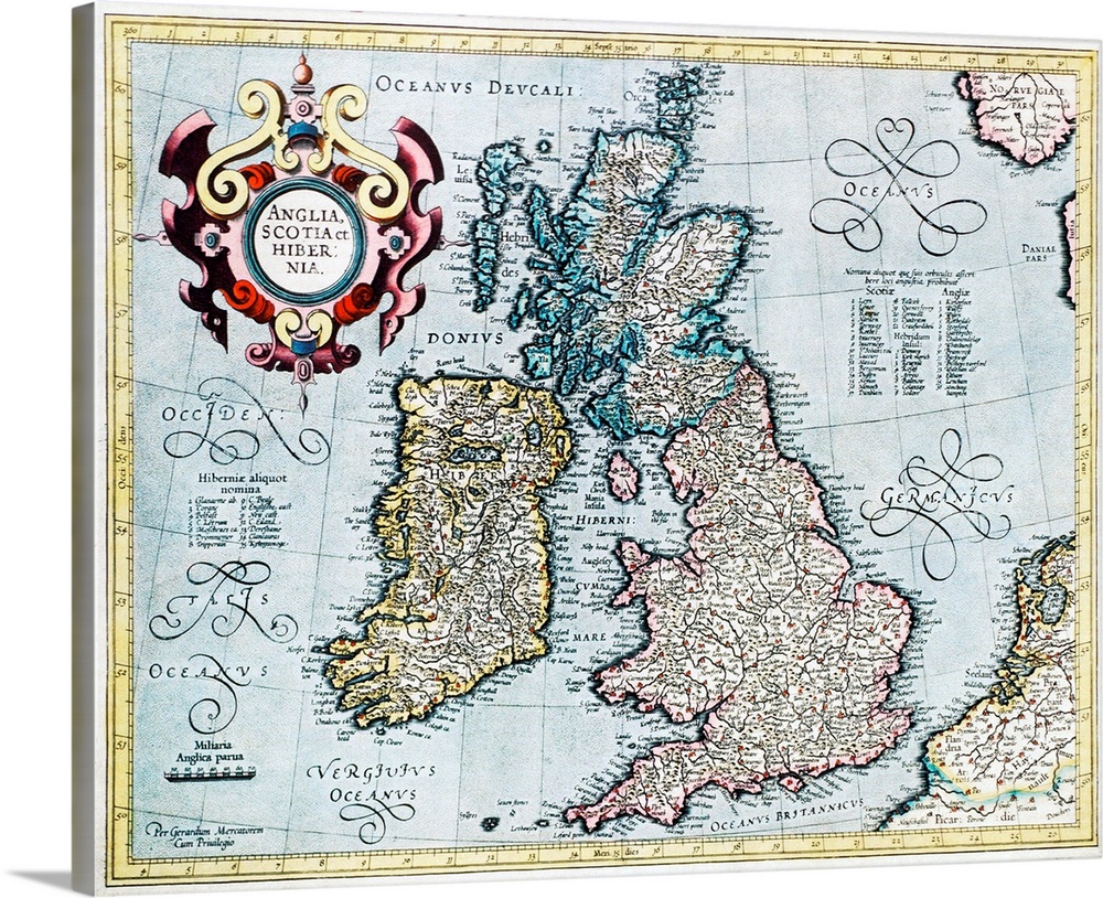
<p>British Isles, 16th century Dutch map. This shows England, Scotland, Wales and Ireland, though Ireland is not yet accurately mapped. Published in 1595, from work by Gerard Mercator.</p>


Elevate any room with our handcrafted stretched canvas gallery wraps. Printed with archival inks and wrapped around a 1.25” inch solid wood stretcher bar, our giclée big canvas art prints are a timeless option for any decor style or space.
<p>Our giclée canvas art prints are produced with high quality, UV-resistant, environmentally-friendly, latex inks and artist grade, polycotton canvas. We pride ourselves on color accuracy and image clarity to ensure your new canvas wall art lasts for years to come.</p>

<p>Assembled in the USA, each of our 1.25” inch gallery wrapped canvas art prints is stretched and stapled by our highly skilled craftspeople. Each canvas print is carefully handcrafted to ensure taut canvas wraps and clean corners for outstanding quality and durability.</p>

<p>Our handcrafted stretched canvas prints include sawtooth hangers for an easy and secure installation.</p>
 Georgette Douwma
Educational
History
World History
Early Modern
Maps
Antique Maps
England
Georgette Douwma
Educational
History
World History
Early Modern
Maps
Antique Maps
England