Skip Menu. Navigate to content in this page
Accessibility Assistance, opens A D A page
Tracking
Favorites
Cart
My Account
Track My Order
My Favorites
Help / Contact Us
Shop By
New!
New Exclusives
New Abstracts
New Florals
New Contemporary Art
New Photography
Gallery Walls
Shop All New!
Best Sellers
Subjects
Popular
Abstracts
Landscapes
Flowers and Botanicals
People
Animals and Wildlife
Scenery by Region
Nature Closeups
City Skylines
Vehicles and Transportation
Architecture
Scenery by Landscape
Trees
Seascapes
Barns
Mountains
Countryside
Lakes
Waterfalls
Lighthouses
Sunsets
Beaches
Scenery by Region
Italy
Hawaii
Canada
Ireland
Paris
New Orleans
Africa
Greece
Popular Wildlife
Horses
Birds
Bison and Buffalo
Cows & Bulls
Dogs
Elephants
Deer
Bears
Shop All Subjects
Colors
Popular
Red Art
Orange Art
Yellow Art
Green Art
Blue Art
Purple Art
Pink Art
Multicolor Art
Black and White Art
Grey Art
Palettes
Pop of Orange
Denim and Leather
Taupe, Linen, and Gray
Blush and Blueberry
Black and Tan
Teal and Copper
Charcoal, Onyx, and Ivory
Luxe Metallics
Earth Tones
Sienna and Navy
Shop All Colors
Styles
Popular
Abstract
Contemporary
Vintage
Figurative
Classic
Street Art
Pop Art
Pixel Art
Portraits
Retro
By Décor Style
Farmhouse
Mid Century Modern
Glam
Bohemian
Coastal
Traditional
Scandinavian
Minimalist
Contemporary
Modern
By Period
Modern
Expressionism
Impressionism
Art Deco
Cubism
Art Nouveau
Realism
Renaissance
Baroque & Rococo
Classicism & Neoclassicism
Shop All Styles
Rooms
Popular
Living Room
Kitchen
Bedroom
Bathroom
Dining Room
Home Gym
Office
Children's Room
Art by Décor Style
Farmhouse
Mid Century Modern
Glam
Bohemian
Coastal
Traditional
Scandinavian
Minimalist
Contemporary
Modern
Shop All Rooms
Artists
Featured
Dorothy Fagan
Gigi Rosado
Bouffants and Broken Hearts
Arty Guava
Nikki Chu
Sydney Edmunds
Victoria Borges
Joyce Combs
Joshua Schicker
RD Riccoboni
Featured Photographers
Valda Bailey
Ansel Adams
Marco Carmassi
Tim Kahane
Ben Pipe
Kathrin Pienaar
Mark Gemmell
Angele Etoundi Essamba
Classic Artists
Gustave Caillebotte
John William Waterhouse
Albert Williams
George Inness
Katsushika Hokusai
Claude Monet
Vincent van Gogh
Pierre Auguste Renoir
Paul Cezanne
Rembrandt van Rijn
Shop All Artists
Featured
Curator's Choice
Ana Rut Bre
Beaming
Femininity Redefined
Freshly Cut
Mediterranean Dream
A Great Escape
Gold Rush
Olive Sprig
Seasonal Collections
Brutalism
Spring Landscapes
Black and White Florals
The New Reds
Rustic Traditionalist
Hot Off the Press
Spring Forward
Demure Harmony
Art & Décor Trends
Breezy Botanicals
Neo-Minimalism
Leanne Daquino
The Botanist
Celebration of Heritage
Wabi - Sabi
Flora And Fauna
Light Academia
Shop All Featured
Gallery Walls
Inspiration
Resources
About
Our Company
Our Products
Trade Program
Gift Cards
Ideas
The Spring Edit
Living Room Ideas
Art for Commercial Spaces
Blog
How to Hang Your Art
Choosing the Right Size Art
What is Japandi?
More Blog Stories
Back
{{ titlePrefix }} Earth
About Earth
Views from Space: Our home planet...from a distant perspective.
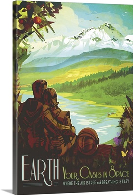
Earth - JPL Travel Poster
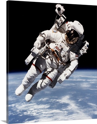
Bruce McCandless floating free from spacecraft in orbit, 1984
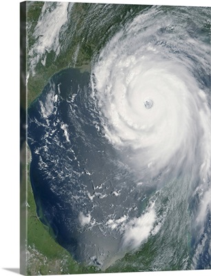
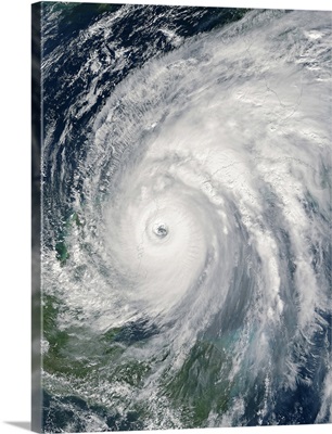
Hurricane Katrina
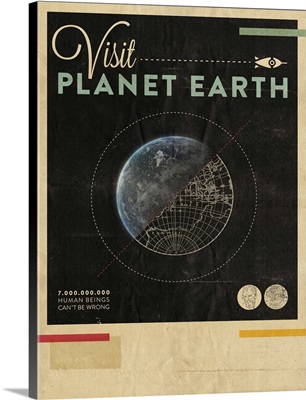
Visit Planet Earth
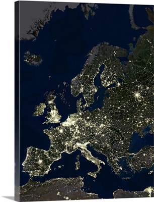
Europe at night, satellite image
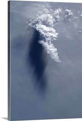
Cloud and shadow, late afternoon over the Ganges River delta
Earth - JPL Travel Poster
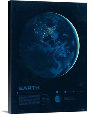
Earth
Sunglint on the Massachusetts coastline
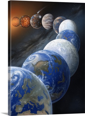
Formation of the Earth, artwork
The Planet Earth
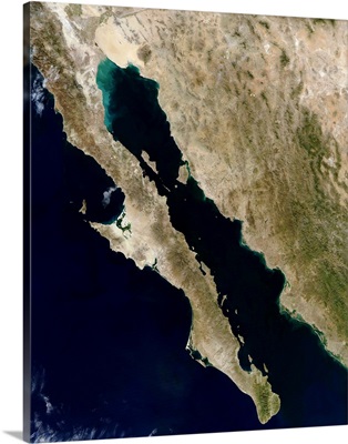
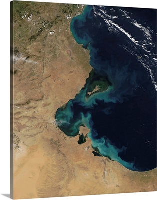
Gulf of California
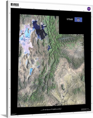
Utah - USGS State Mosaic
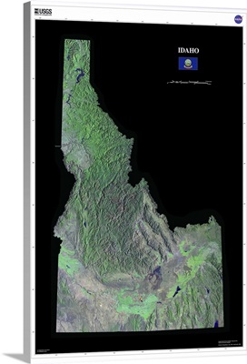
Idaho - USGS State Mosaic
Resuspended sediment off the coast of Tunisia
Hurricane Wilma over Mexico
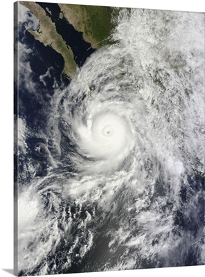
Hurricane Odile southeast of the Baja California peninsula
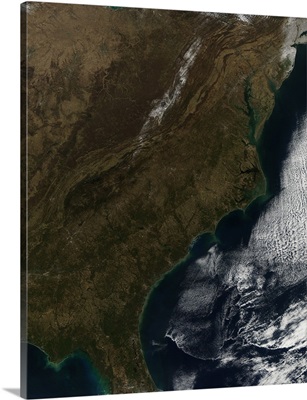
Satellite view of the Southeastern United States
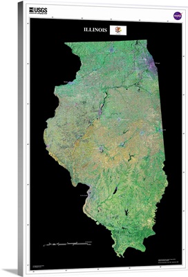
Illinois - USGS State Mosaic
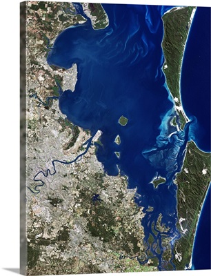
Brisbane, Australia, satellite image
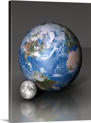
Earth alongside the Moon showing the difference in scale.
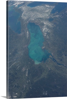
View from space of Lake Ontario
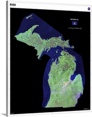
Michigan - USGS State Mosaic
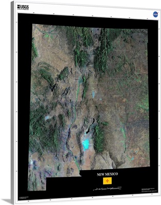
New Mexico - USGS State Mosaic
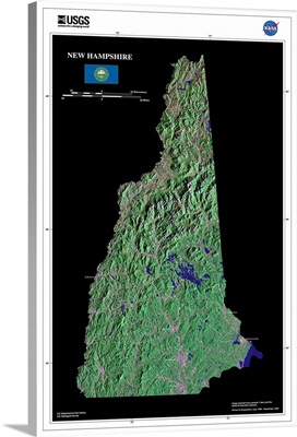
New Hampshire - USGS State Mosaic
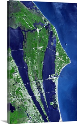
The John F Kennedy Space Center Americas spaceport
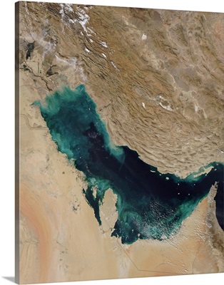
Persian Gulf
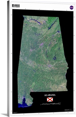
Alabama - USGS State Mosaic
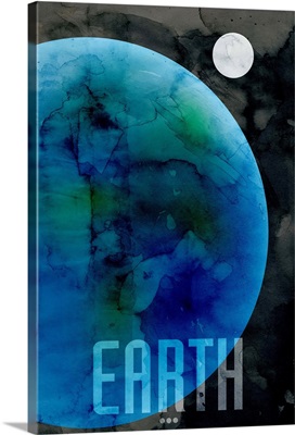
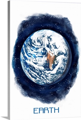
Earth - Watercolor
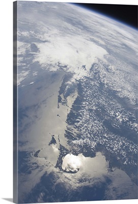
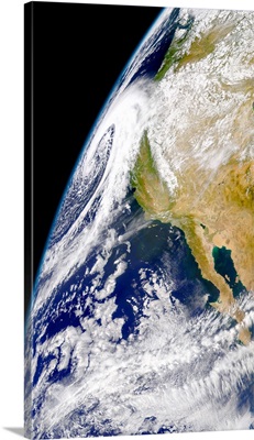
A massive low pressure system approaching the northern California coast
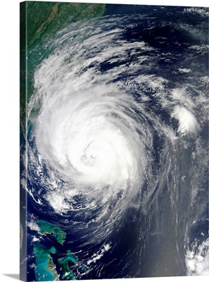
Hurricane Earl grazing the North Carolina coast
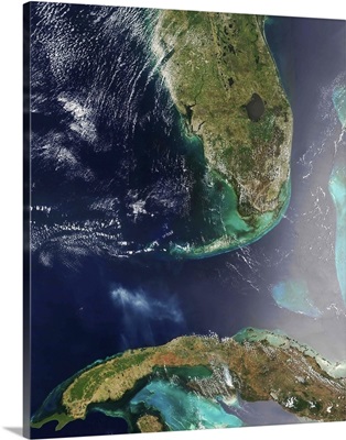
Florida and Cuba
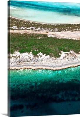
Aerial View Of Exuma Cays, Bahamas
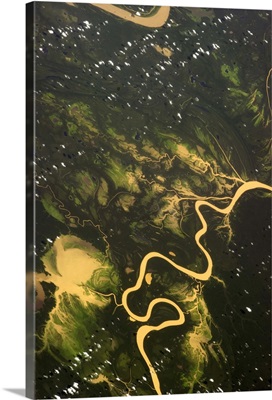
The incredibly green lush wetness of the Amazon basin
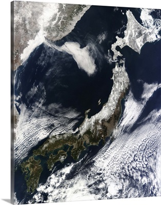
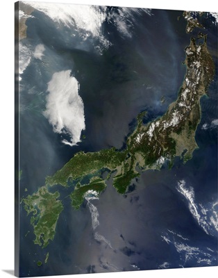
Satellite view of Japan
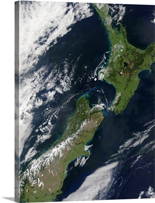
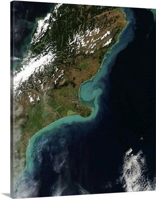
New Zealand
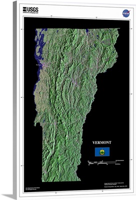
Vermont - USGS State Mosaic
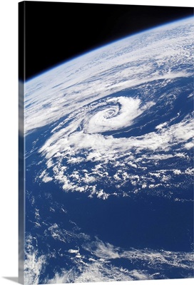
A subtropical cyclone
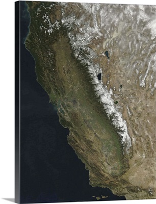
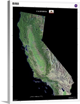
California
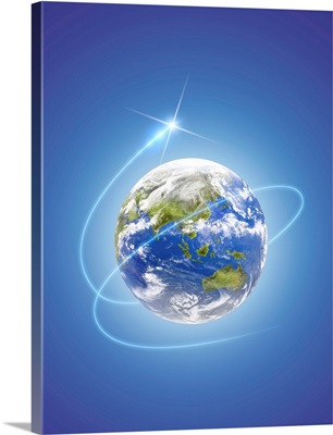
Network light surrounding the earth, computer graphic, blue background
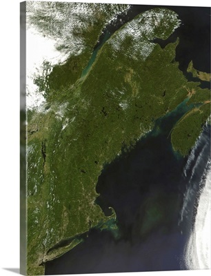
Satellite view of New England
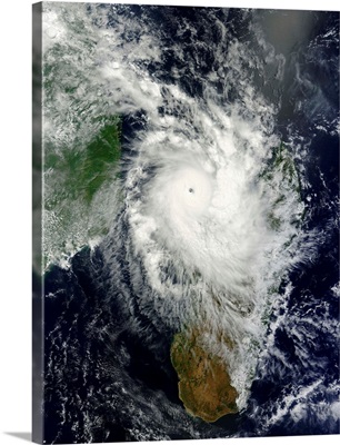
Tropical cyclone Hellen spins offshore Madagascar
California - USGS State Mosaic
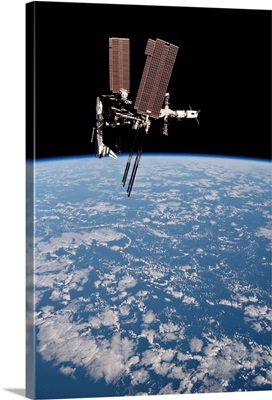
The International Space Station in orbit above Earth
Japans main island Honshu
Satellite view showing sediment near Christchurch, New Zealand
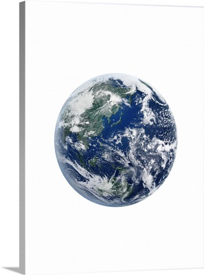
The earth, computer graphic, white background
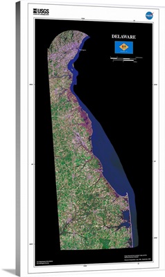
Delaware - USGS State Mosaic
Page 2