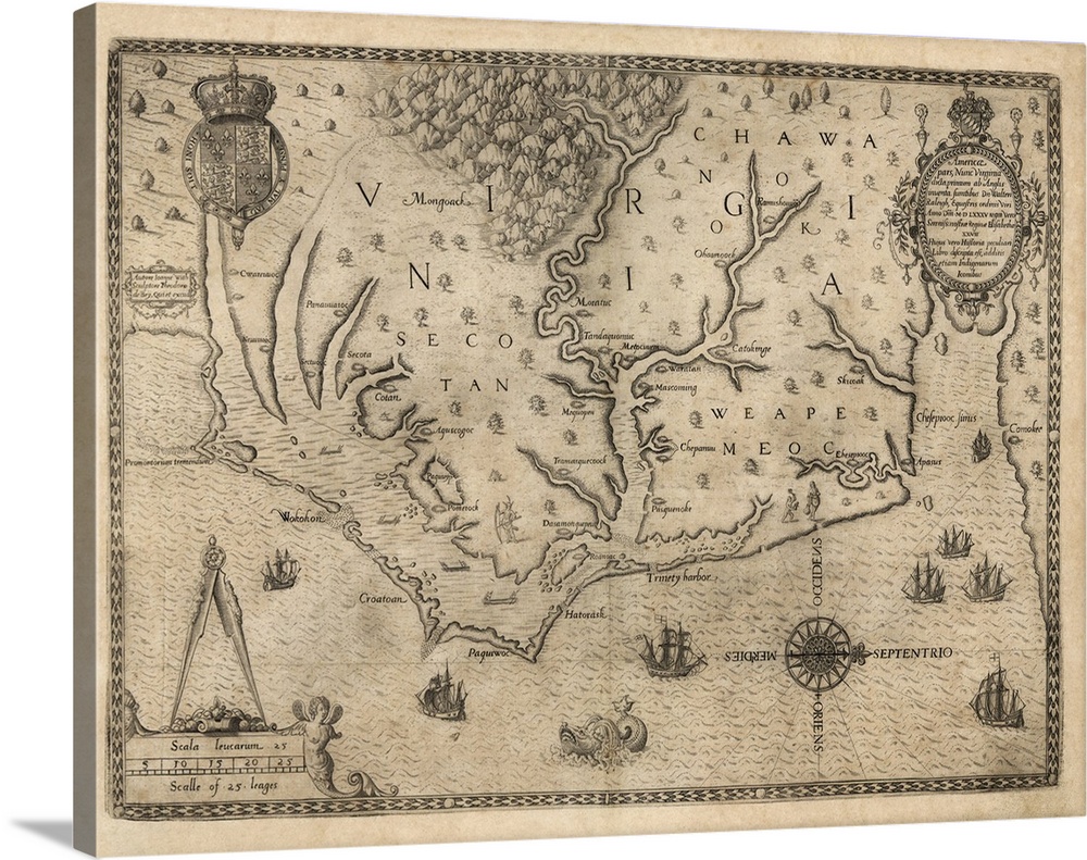
<p>US colony of Virginia, 16th century map. North is at right. The map goes from Cape Fear (left) to Chesapeake Bay (right), and is labelled with the location of indigenous tribes in the area. Known as the White-de Bry map of Virginia, this map was published by Theodore de Bry in 1590, but is based on an earlier map from 1585 by John White. It was published with Thomas Harriot's A Briefe and True Report of the New Found Land of Virginia, and was the first printed map to show an area of the USA to this level of detail. White was part of a company sent by Sir Walter Raleigh to establish an English colony on Roanoke Island (lower centre), at the mouth of Albemarle Sound. Sir Walter Raleigh and the English Queen, Elizabeth I, are mentioned in the Latin text at upper right.</p>


Elevate any room with our handcrafted stretched canvas gallery wraps. Printed with archival inks and wrapped around a 1.25” inch solid wood stretcher bar, our giclée big canvas art prints are a timeless option for any decor style or space.
<p>Our giclée canvas art prints are produced with high quality, UV-resistant, environmentally-friendly, latex inks and artist grade, polycotton canvas. We pride ourselves on color accuracy and image clarity to ensure your new canvas wall art lasts for years to come.</p>

<p>Assembled in the USA, each of our 1.25” inch gallery wrapped canvas art prints is stretched and stapled by our highly skilled craftspeople. Each canvas print is carefully handcrafted to ensure taut canvas wraps and clean corners for outstanding quality and durability.</p>

<p>Our handcrafted stretched canvas prints include sawtooth hangers for an easy and secure installation.</p>
 Maps
Art
Beige
Maps
United States
Virginia
Vintage Art
Maps
Art
Beige
Maps
United States
Virginia
Vintage Art