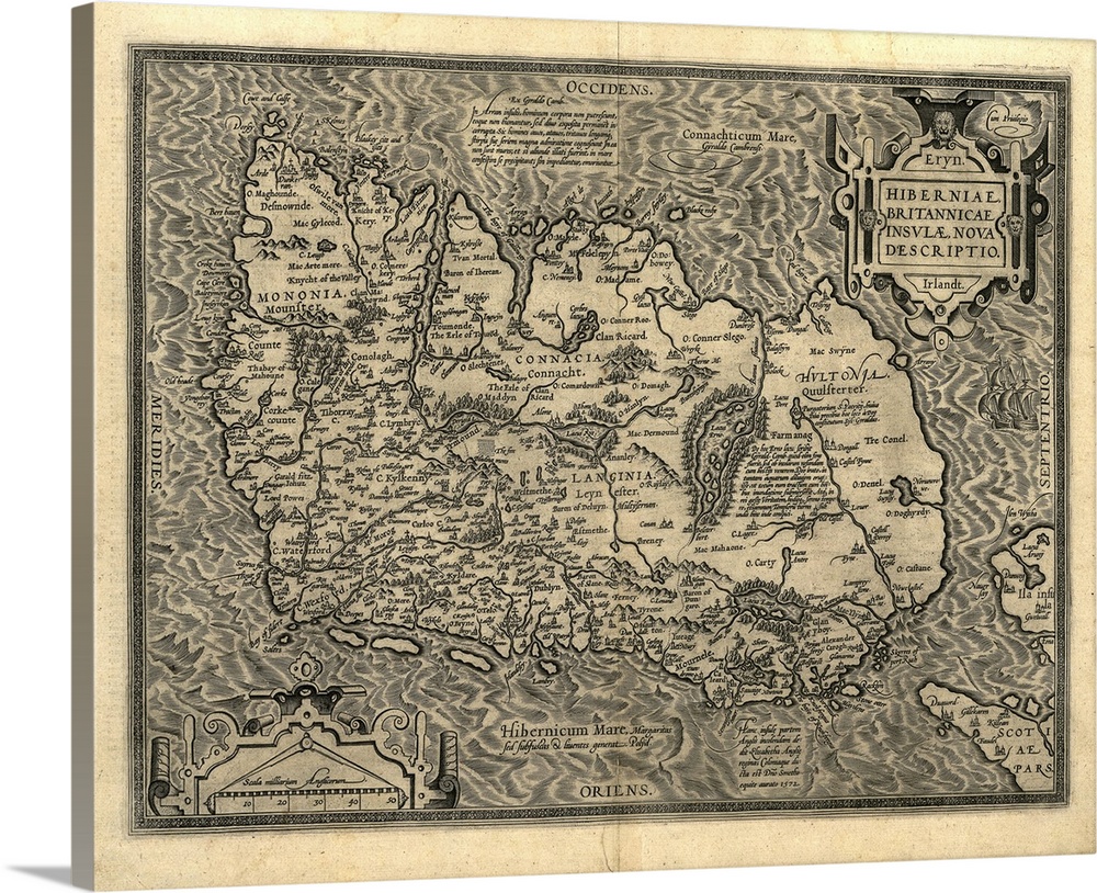
<p>Ortelius's map of Ireland, from an atlas of 1598. North is at right. This map is titled: Hiberniae, Britannicae Insulae Nova Descriptio (A new depiction of Ireland, a British Isle). It is based on Mercator's 1564 map. The map text is in Latin and mentions Queen Elizabeth I of England, who was also Queen of Ireland. Quotes are also given from the scholar Gyraldus Cambrensis (Gerald of Wales), coning the isles of Arran, Saint Patrick's Purgatory, and Lacus Erno (Lough Erne). A scale is at lower left. Abraham Ortelius (1527-1598) was a Flemish mapmaker who is considered to have produced the first true atlas (collection of uniform maps in one book).</p>


Elevate any room with our handcrafted stretched canvas gallery wraps. Printed with archival inks and wrapped around a 1.25” inch solid wood stretcher bar, our giclée big canvas art prints are a timeless option for any decor style or space.
<p>Our giclée canvas art prints are produced with high quality, UV-resistant, environmentally-friendly, latex inks and artist grade, polycotton canvas. We pride ourselves on color accuracy and image clarity to ensure your new canvas wall art lasts for years to come.</p>

<p>Assembled in the USA, each of our 1.25” inch gallery wrapped canvas art prints is stretched and stapled by our highly skilled craftspeople. Each canvas print is carefully handcrafted to ensure taut canvas wraps and clean corners for outstanding quality and durability.</p>

<p>Our handcrafted stretched canvas prints include sawtooth hangers for an easy and secure installation.</p>
 Educational
History
Maps
Antique Maps
Maps by Country
Ireland
Educational
History
Maps
Antique Maps
Maps by Country
Ireland