<p>United States Geological Survey is a government agency that studies the geology of the US, as well as its effects and resources. Through their research, the USGS has created stunning images of the earth as seen from satellites, highlighting the natural beauty of the world.</p>
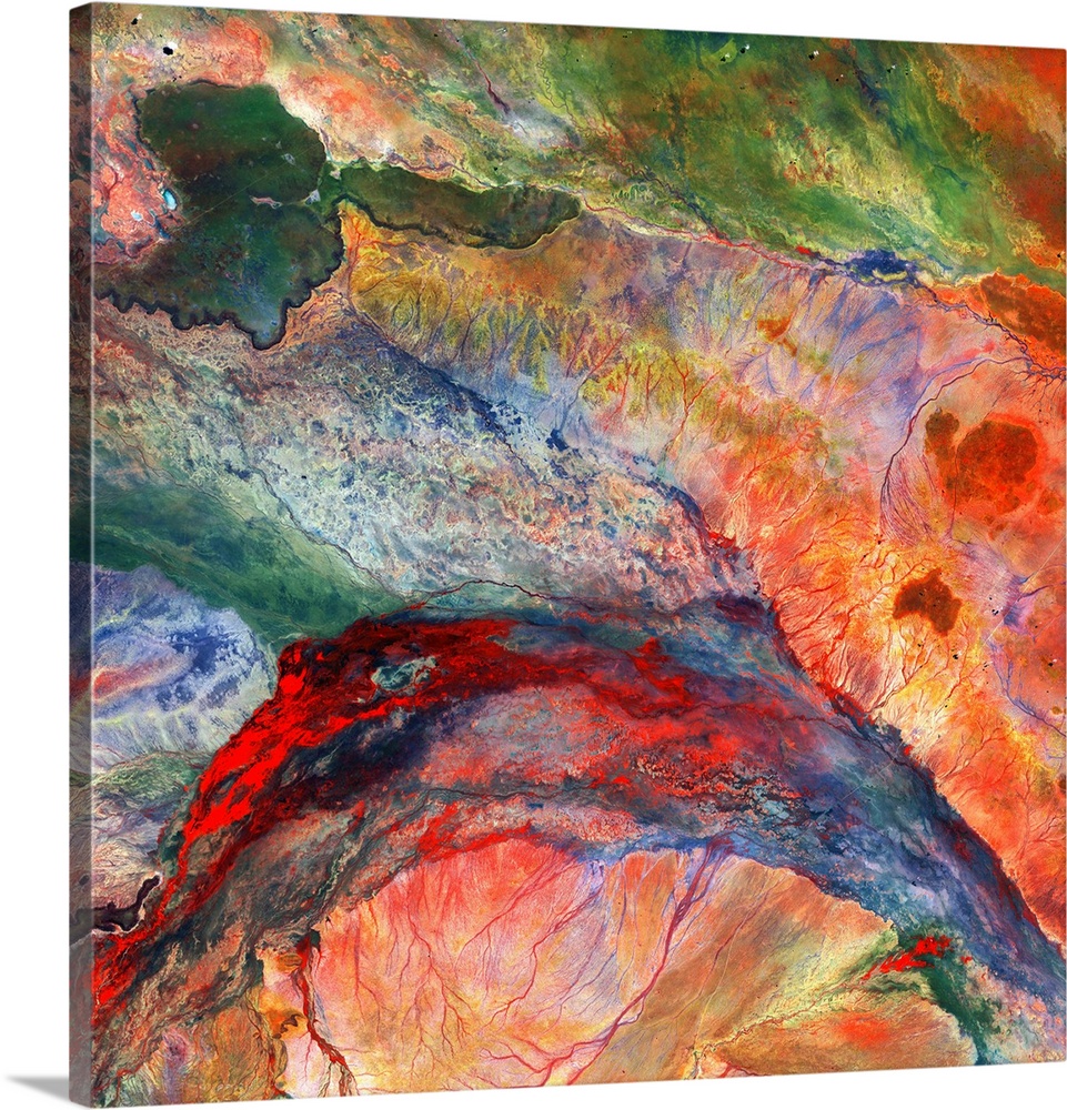
<p>Lorian inland delta and swamplands, satellite image. In this area of north-eastern Kenya, water flows out of an inland delta into semiarid plains, forming the wetland and swamp patterns across lower centre. At upper left is a region of hard basaltic rock (dark colours) from an ancient lava flow. Image data obtained by the Landsat 8 satellite on 3 May 2014.</p>


Elevate any room with our handcrafted stretched canvas gallery wraps. Printed with archival inks and wrapped around a 1.25” inch solid wood stretcher bar, our giclée big canvas art prints are a timeless option for any decor style or space.
<p>Our giclée canvas art prints are produced with high quality, UV-resistant, environmentally-friendly, latex inks and artist grade, polycotton canvas. We pride ourselves on color accuracy and image clarity to ensure your new canvas wall art lasts for years to come.</p>

<p>Assembled in the USA, each of our 1.25” inch gallery wrapped canvas art prints is stretched and stapled by our highly skilled craftspeople. Each canvas print is carefully handcrafted to ensure taut canvas wraps and clean corners for outstanding quality and durability.</p>

<p>Our handcrafted stretched canvas prints include sawtooth hangers for an easy and secure installation.</p>
 United States Geological Survey