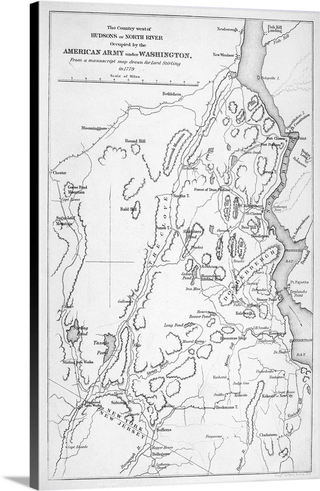
<p>Hudson River, Military Map. the Country West Of Hudson River, Occupied By the Continental Army Under George Washington. From A Manuscript Map Drawn For Lord Stirling, 1779.</p>
Elevate any room with our handcrafted stretched canvas gallery wraps. Printed with archival inks and wrapped around a 1.25” inch solid wood stretcher bar, our giclée big canvas art prints are a timeless option for any decor style or space.
Long-Lasting Color and Detail
<p>Our giclée canvas art prints are produced with high quality, UV-resistant, environmentally-friendly, latex inks and artist grade, polycotton canvas. We pride ourselves on color accuracy and image clarity to ensure your new canvas wall art lasts for years to come.</p>
Handcrafted Gallery Wraps
<p>Assembled in the USA, each of our 1.25” inch gallery wrapped canvas art prints is stretched and stapled by our highly skilled craftspeople. Each canvas print is carefully handcrafted to ensure taut canvas wraps and clean corners for outstanding quality and durability.</p>
Easy to Install
<p>Our handcrafted stretched canvas prints include sawtooth hangers for an easy and secure installation.</p>