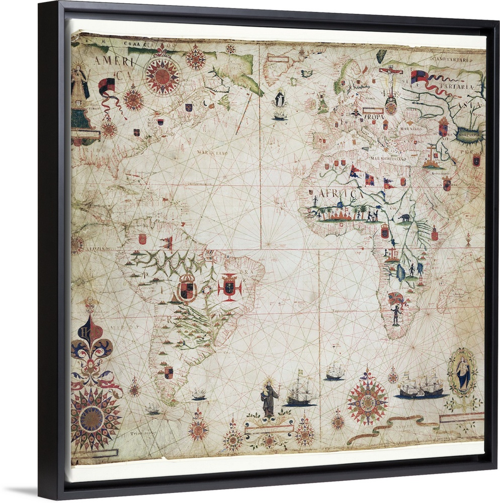
<p>17th Century nautical map of the Atlantic Ocean. Historical portolan chart showing the Atlantic Ocean and adjacent continents. Portolan charts are navigational maps based on realistic descriptions of harbours and coasts. Along with the Atlantic, this chart shows the southeast Pacific Ocean, southwest Indian Ocean and the continents of South America, Africa, Europe, and parts of North America and Asia. Created by Pascal Roiz in 1633.</p>


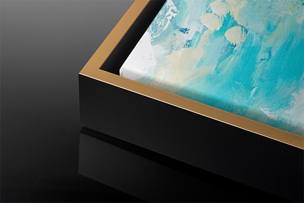
Elevate your home or office décor by adding a modern floating frame to your canvas art print. Finishing your gallery wrapped canvas with a floating frame enhances the beauty and detail of our giclée art prints. Handcrafted from solid wood, and available in multiple finish colors, there’s sure to be a frame to accent your canvas art print.
<p>Create the illusion that your new gallery wrapped canvas art is suspended in space with our premium 1.75” inch deep floating frame. With several available frame finishes to choose from, you’re sure to find the color that best accents your handcrafted art and personal décor.</p>

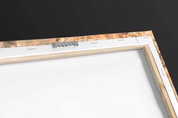
<p>Our floating frame prints feature giclée printed canvas produced with high quality, UV-resistant, environmentally-friendly, latex inks and artist grade, polycotton canvas. We pride ourselves on color accuracy and image clarity to ensure your new canvas print lasts for years to come.</p>
<p>The lightweight construction and pre-installed sawtooth hangers make installation a breeze. Even though they're light, our rock-solid construction boasts long-lasting durability.</p>
 Maps
Antique Maps
World Maps
Maps
Antique Maps
World Maps