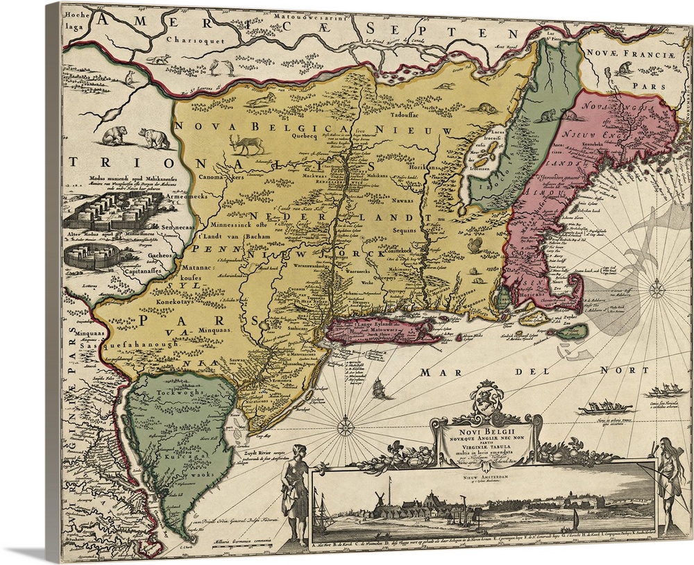
<p>Shows the eastern coast of the US from the Chesapeake Bay north to Maine. The Dutch colony is shown in yellow, the British colony of New England in pink, and other regions in green whose borders were in a state of change in the late 17th century (present-day Vermont in the north, and Delaware and the eastern shore of Maryland in the south). At the bottom right is the often copied inset view of New Amsterdam (renamed to New York in 1664 by the British) depicting the fort, windmill, and numerous buildings and ships of the Dutch settlement.</p>


Elevate any room with our handcrafted stretched canvas gallery wraps. Printed with archival inks and wrapped around a 1.25” inch solid wood stretcher bar, our giclée big canvas art prints are a timeless option for any décor style or space.
<p>Our giclée canvas art prints are produced with high quality, UV-resistant, environmentally-friendly, latex inks and artist grade, polycotton canvas. We pride ourselves on color accuracy and image clarity to ensure your new canvas wall art lasts for years to come.</p>

<p>Assembled in the USA, each of our 1.25” inch gallery wrapped canvas art prints is stretched and stapled by our highly skilled craftspeople. Each canvas print is carefully handcrafted to ensure taut canvas wraps and clean corners for outstanding quality and durability.</p>

<p>Our handcrafted stretched canvas prints include sawtooth hangers for an easy and secure installation.</p>
 US History
Colonization
Maps
Antique Maps
Massachusetts
New Hampshire
New Jersey
Rhode Island
Vermont
US History
Colonization
Maps
Antique Maps
Massachusetts
New Hampshire
New Jersey
Rhode Island
Vermont