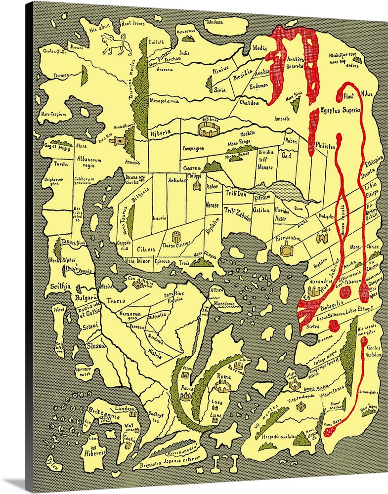
<p>Anglo-Saxon world map, dating from the 10th century. East is top. This map of the known world was probably produced by an Irish monk. Considering the state of European learning at the time, it is an impressive geographical achievement. However, in terms of accuracy it is outclassed by maps dating from the Classical era. Important landmarks, such as Jerusalem and Rome, are marked. The original is part of the Cotton, held in the British. Taken from A Book of Discovery (1912) by M.B. Synge.</p>


Elevate any room with our handcrafted stretched canvas gallery wraps. Printed with archival inks and wrapped around a 1.25” inch solid wood stretcher bar, our giclée big canvas art prints are a timeless option for any décor style or space.
<p>Our giclée canvas art prints are produced with high quality, UV-resistant, environmentally-friendly, latex inks and artist grade, polycotton canvas. We pride ourselves on color accuracy and image clarity to ensure your new canvas wall art lasts for years to come.</p>

<p>Assembled in the USA, each of our 1.25” inch gallery wrapped canvas art prints is stretched and stapled by our highly skilled craftspeople. Each canvas print is carefully handcrafted to ensure taut canvas wraps and clean corners for outstanding quality and durability.</p>

<p>Our handcrafted stretched canvas prints include sawtooth hangers for an easy and secure installation.</p>
 History
World History
Early Modern
Maps
Antique Maps
Sheila Terry
History
World History
Early Modern
Maps
Antique Maps
Sheila Terry