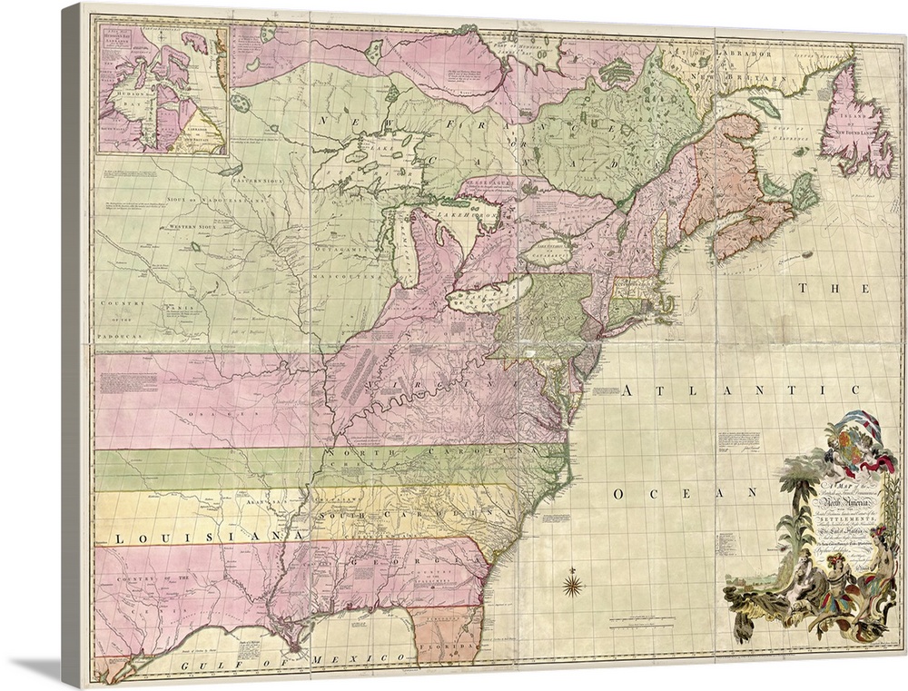
<p>Considered by some to be the most important map in the history of the United States, Mitchell's 1755 map of the British colonies served as the foundation for establishing the boundaries of the new country at the Treaty of Paris in 1783 after the American Revolutionary War.</p>


Elevate any room with our handcrafted stretched canvas gallery wraps. Printed with archival inks and wrapped around a 1.25” inch solid wood stretcher bar, our giclée big canvas art prints are a timeless option for any décor style or space.
<p>Our giclée canvas art prints are produced with high quality, UV-resistant, environmentally-friendly, latex inks and artist grade, polycotton canvas. We pride ourselves on color accuracy and image clarity to ensure your new canvas wall art lasts for years to come.</p>

<p>Assembled in the USA, each of our 1.25” inch gallery wrapped canvas art prints is stretched and stapled by our highly skilled craftspeople. Each canvas print is carefully handcrafted to ensure taut canvas wraps and clean corners for outstanding quality and durability.</p>

<p>Our handcrafted stretched canvas prints include sawtooth hangers for an easy and secure installation.</p>
 US History
Colonization
Maps
Antique Maps
Maps by Country
United States Maps
US History
Colonization
Maps
Antique Maps
Maps by Country
United States Maps